
In this article, you’ll learn:
If you are already using Pics.io DAM service to keep your digital assets in order, you might have wondered if there’s a way you could display your photo library on a map somehow and quickly search within it to find the photos and videos you require.
Such map data visualization has to show geo-tagged assets either photos or videos and help to find any asset in a particular location. Applied wisely, it can become a key storytelling tool helping the company to win new business and provide clients with decision-making insight and support.
That’s exactly the purpose of the Map View Data Visualization tool from Pics.io
A couple of days ago we released this new feature in Pics.io, and now it’s time to tell you more about how Map View works in Pics.io, and what’s in it for you and your business.
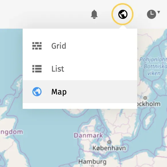
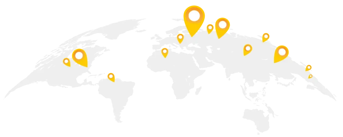
The Map View mode is an additional viewing and sorting mode to customize the way you view your assets inside a collection in Pics.io. The Map View mode allows you to show all geo-tagged assets on a map. Using this view mode it’s possible to see the geographical location of your photos and videos across the world.
Every time you upload a new asset with geo-tagging to your Pics.io library, it becomes part of your map photo albums and can be easily found in the future. In case the file doesn’t contain any information about its geographical location you have several options to add required geo-tag to your photo map. As a result, you can overview your pictures on a single map and show them to your clients with one single click.
That’s it!
Map View is a great tool to have for visualization and navigation across your files. It is one of the easiest ways to turning something complex into something easy to see and understand immediately. If you want to easily find the geographical location of your images and videos inside your collections we are again here to help.
Got any ideas who you can make the most of this new feature?
With Map View feature from Pics.io:
- Commercial companies can now use maps in sales meetings, advertising, or to display brick-and-mortar locations.
- Non-profit institutions can share photos with their donors that highlight the results of their projects at a local, regional, or global scale
- Marketing agencies can easily find images made at specific location and add selected images into a new collection labeling them by the neighborhood they are in.
- The tourism and hospitality sector can display to their potential clients the photos and videos of the places they plan to visit.
Map view is a compass for marketing departments of any kind
The location of photos on a single map is a unique compass for your marketing team. Whenever you require to find the photoset from the particular event you can use Map View feature at your convenience. If you are an educational institution or non-profit organization hosting an event in several geographical locations, you can easily overview its images on a single map and prepare the marketing report on its effectiveness with proper illustrations within.
If you are a PR or advertising agency you have a lot of situations where your client needs to use an image featuring a specific thing. Someone on your team might find one image of that thing, but you might memorize you had some great image of that spot a year ago and just can’t figure out where its located.
For example, our users from RocketBrand wanted to have a ‘global map’, that they could zoom around on like google maps, which shows clusters of geo-tagged images and video clips as well as other media geo-tagged nearby. RocketBrand is a branding agency that accumulates content from numerous contributors. So, being able to easily find assets in numerous locations is one of the priorities for them.
That user request gave a start for the development of our Map View feature at Pics.io and currently it allows to pull a map showing other media geo-tagged nearby and add selected images into a new collection labeling them by the neighborhood they are in. As a result, you will streamline navigation across your multiple assets and raise your marketing productivity to a new level.
Map View is a unique exploration guide for travel agencies worldwide.
If you are the tourist agency map data visualization can help to easily find various sightseeing places. You can show your clients what attractions exist at the place where they plan to travel. It can be easily done with a variety of customizable websites at Pics.io. Imagine your client is planning a short trip to New York. This beautiful city is full of art galleries, parks, museums, and marinas and it is a real challenge what to see first.
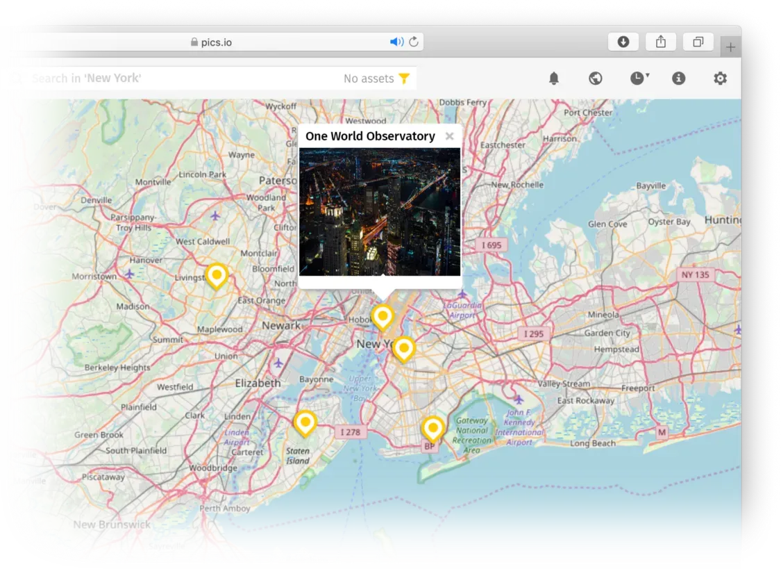
Presenting the New York tour to your potential client you can easily find places interesting to see featured on the city map. You can also display the photos and videos of the hotels where he can stay during the trip and the distance from these hotels to the most popular attractions. As a result, your client can easily plan his activities in New York and choose the best place to stay according to his requirements.
If you are also using drone technology to produce affordable aerial videos and photographs to promote tourist attractions and resorts the map view can help you easily find them in the digital library and to showcase the best attractions of any city, country or island to your prospective clients.
Map View is an exclusive search tool for real-estate sector
Let’s consider the case of a real-estate agency delivering integrated real estate solutions to clients around the world. Those clients fall into two types: occupiers and investors. Occupiers are users of commercial real estate such as tenants of an office tower. Investors are the owners of the real estate.
So, whether a tenant is contemplating a new location for its growing business or an owner is looking to buy, lease, or sell a property, these decisions often have long-term implications and represent millions of dollars. The consolidations of properties and easy navigation across them on one map with geotags can help the occupiers and investors to win their clients.
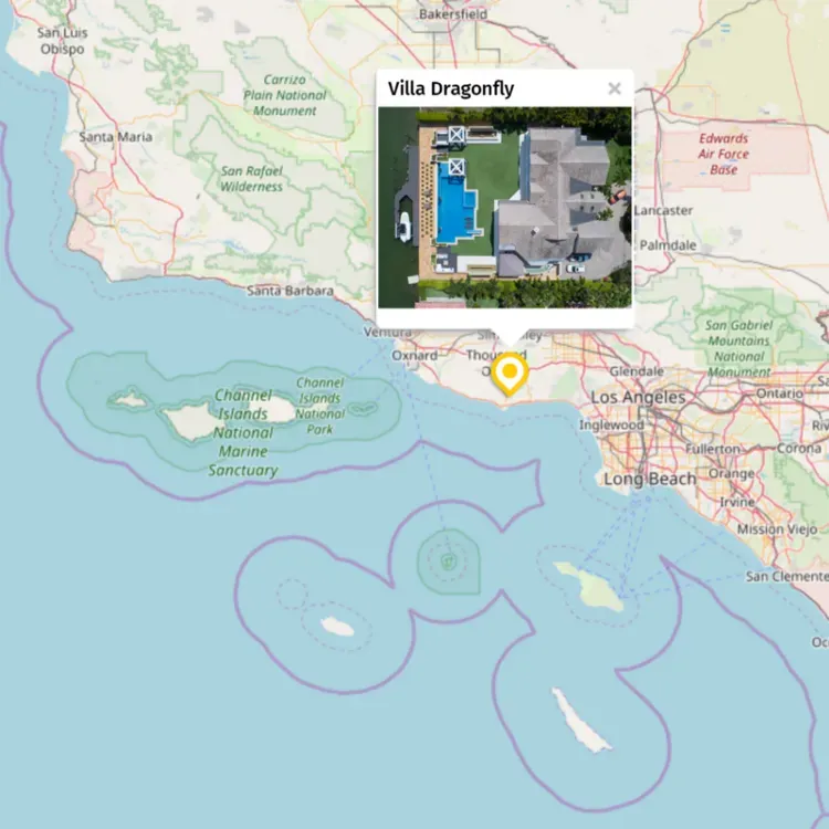
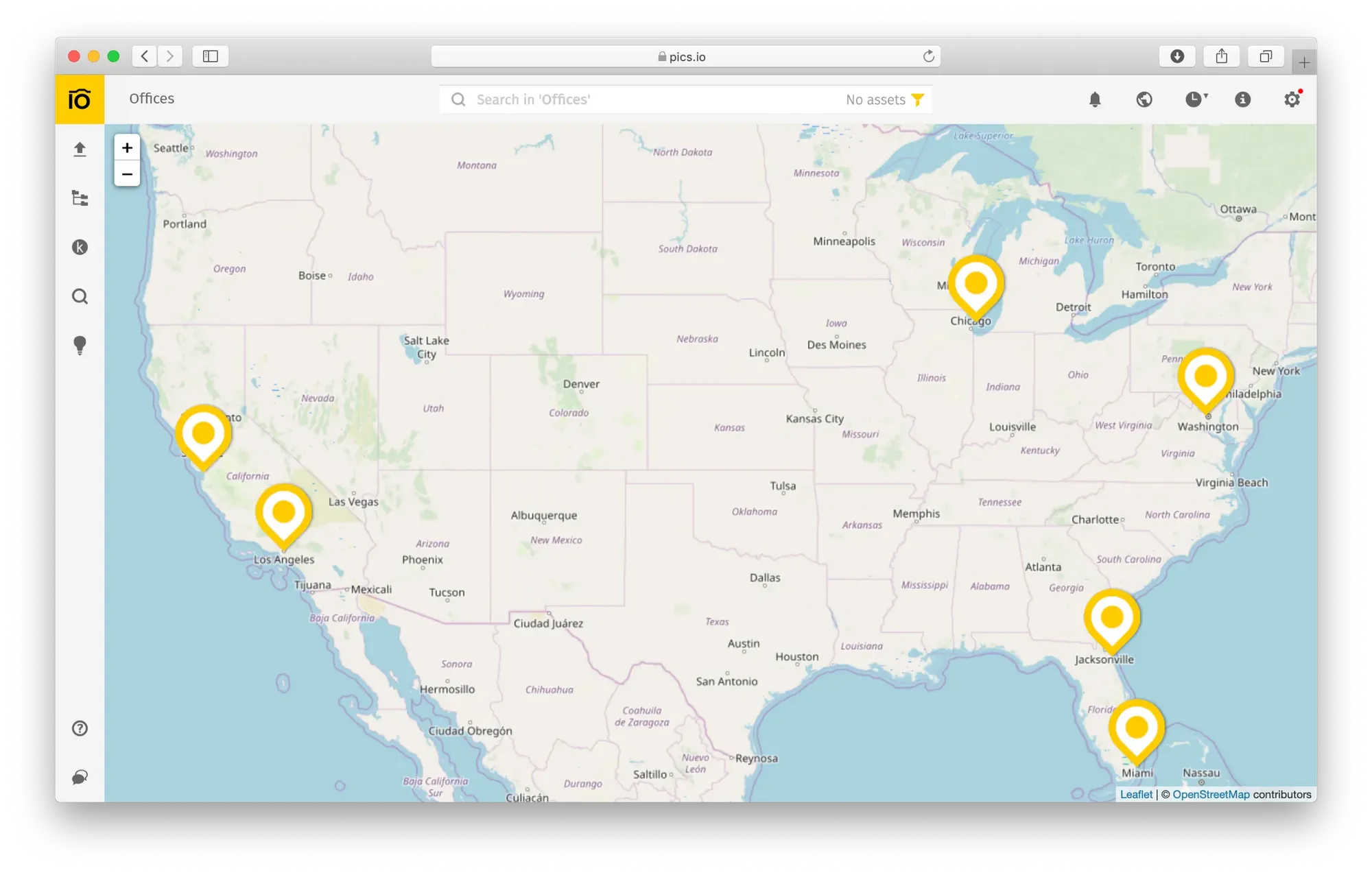
Imagine, you would like to show to your potential client all the luxurious houses on the West Coast. To do this just go to the necessary collection with your West Coast houses and in the top right toolbar of Pics.io account switch to the Map View mode. All the map geotagged photos and videos from this very collection will appear on a single map according to their geographical location.
These images will form clusters of different colors depending on a number of files within each cluster. You can also sort the houses on the map according to certain characteristics, including price, distance to the ocean, the amount of premises, etc. and place the stars, flags, and color labels on the files you require. Such an approach will simplify the navigation and visualization of the available houses telling their story to potential clients.
Explore new opportunities with Map View from Pics.io
In a world of increasing data and demand for decision-making support, companies are challenged to find better, faster, and more efficient ways to help clients through data search and storytelling.
Map View data visualization is a key storytelling tool that helps the company win new business and provide clients with decision-making insight and support. Communicate with your clients on the new level with Map View from Pics.io. Be as our RocketBrand users — ask for the features you require and we will do our best to meet your needs. Let’s develop Pics.io together!
If you’re interested to learn more about how to use Map View in Pics.io, and especially about how to get most of geotags on your photos I’ve mentioned before — welcome to our Help Center where there’s more technical information.
Try to use our Map View feature and give us feedback! If you haven’t registered yet, follow this link to create a free account now.


